When I shoot on my own, I use a GPS to tag the location where I took the image. That’s so when I go back and look at images years later, I can find the name of the site/object I took the picture of (it’s great for geyser names for example). I always remove those coordinates from the metadata before uploading, to keep locations from getting over-used.
When I take a workshop though, I’m respectful of the instructor. Some don’t mind, but most prefer that students don’t use GPS – after all, these secret locations are their bread and butter.
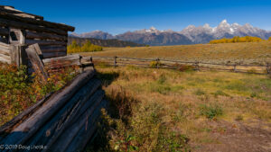
That’s the case here – it’s at the ruins of a cabin in Montana, but I don’t remember the name. One of those hidden gems that the local guides know about, but will now remain nameless!


